How to organise your group’s door to door leafleting
Basic Tools that will help:
- Your Council’s website.
- The Ordnance Survey online election map: https://www.ordnancesurvey.co.uk/election-maps/gb/
- Google maps: https://www.google.com/maps/
- A “web clipper” to copy and paste from a defined area on your computer screen. eg One Note, Evernote.
- Ideally a gmail address. If you use a mail client like Outlook you can get this client to receive mails alongside those from your existing email account.
Techniques you can choose between or “mix and match”, starting with the simplest:
1. Print off from your Council web site.
Most Councils have a set of pdf maps located under “electoral services” or “local democracy” or something similar. Search on “ward maps”. These can usually be downloaded and printed off. Then it is just a matter of identifying a block of streets that makes sense for one group to handle and marking it clearly with felt-tip. If the ward maps are further sub-divided into voting areas around polling stations (whose exact location is published anew for each election or other vote), these walks should be further sub-divisions of the voting areas. Volunteers should mark the routes they have covered and note any difficulties or obvious signs of political stance (like window posters).
Sometimes the Council goes for a more sophisticated solution like an integrated online map showing different boundaries and pinpoint locations that can be turned on and off and zoomed into. Here the solution is to use a screen-grab utility or a web-clipper as integrated into Evernote or Microsoft OneNote. Clip an area corresponding to the ward or voting area and then save the clip as a file that should be stored in an accessible location (UKPEN.eu makes 12 regional Google drives available, but storage can also be on the group’s own account.)
Ask volunteers to return the sheets physically or via an emailed photo.
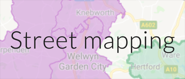
2. Cut and paste from OS election maps.
Ordnance Survey have made a Great Britain map freely available online. You can locate and zoom in on your constituency, and a panel of controls on the left of the screen allows you to turn on a maximum of two of the available boundary line sets. The first selected is thick red and the second is fine black. Typically the first should be constituency, the second ward. Zoom in to the scale that allows the desired area to be shown on your computer screen and then clip using your preferred web-clipper. Alternatives exist in the shape of maps based on OS data, such as here https://www.electoralcalculus.co.uk/homepage.html where (right hand column) there is a postcode lookup that takes you to a constituency and ward map.
As in 1, clip an area corresponding to the ward or voting area and then save the clip as a file that should be stored in an accessible location (UKPEN.eu makes 12 regional Google drives available, but storage can also be on the group’s own account.)
Ask volunteers to return the sheets physically or via an emailed photo.
3. Do a full UKPEN-style location map and guide to walks within a grid on that location map.
See eg https://sites.google.com/view/london-pro-european-network/east/lb-havering/dagenham-and-rainham for an example of how an action day with 40 volunteers was organised in this constituency. The detailed techniques required to make the grid and demarcation lines are spelled out in detail in the Vote for Europe guides to making campaign maps the UKPEN version of which can be consulted here in pdf, and here in Word format. See these pages for how to integrate the People’s Vote turf cutter into the UKPEN approach: http://bit.ly/UKPENBlackheath (click through to polling disticts).
4. Google maps.
David Tate, in conjunction with Tim Lund, has created customised Google maps for dozens of local groups to help them plan and keep track of leafleting walks. These maps show the Constituency boundaries, Ward boundaries and Polling District boundaries in your area and you are able to add walking routes and target areas to your map to share with your team. If you would like a map of your area to be created and to be given access to it for your own use, contact David Tate on HH.PeoplesVote@gmail.com and he will make it happen for you, usually on the same day.
The ways of using these custom Google maps and the local data provided on them continue to grow, with many exciting possibilities for a People’s Vote.
You can see the guidance that David has already produced on how to use custom Google maps by going to this Toolbox page.